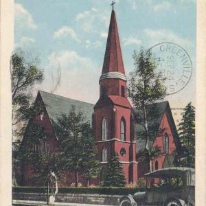
This collection contains picture postcards from the early part of the twentieth century that depict scenes across South Carolina. Items in this collection are held by the Greenville County Library System’s South Carolina Room.
This is a collection of over 700 South Carolina county road maps from 1930s to the 1990s, courtsey of the University of South Carolina Thomas Cooper Map Collection.
The South Carolina State Library and the South Carolina Digital Library present the South Carolina Bookmobiles Collection, a collection of historical and contemporary images from the 1940s to the early 2000s. The photographs are from the archives of the South Carolina State Library and many were taken by State Library field agents. Portrayed in photographs …
A collection of photographs, manuscripts, books, and maps from the Civil War era from the University of South Carolina Libraries with essays from Dr. Thomas J. Brown and Dr. Dorothy Pratt. This collection will continue to have materials added to it.
Spanning five decades, the University of South Carolina’s collection of aerial photograph indexes consists primarily of projects commissioned by the United States Department of Agriculture. Showing cities, farms, forests, reservoirs, coastlines, and other features across the state, the indexes provide a visual overview of each project’s collection of individual aerial photographs, many of which are …
The South Caroliniana Library has been collecting photographs of train stations, depots, rail yards, engines, and rolling stock for many years. The images come in as single items, as part of other collections, or as collections of their own. There are also photographs of railways used by the mining and lumber industries. Presented here are …
Since 1911 the South Carolina State Department of Education has published a yearly directory of schools in the state. Information catalogued in each issue is different; some issues include school and district information, Department of Education staff and programs, listings of private schools and colleges, statistics, and state educational associations. These directories provide valuable information …
Measuring 14 ½ x 20 inches the Polyconic Projections were first published in the late 19th Century. Some were produced by the Army, others by the Corps. of Engineers and the remainder were produced by the United States Geological Survey (USGS). The scale is 1:62500. The contour intervals vary. Measurements are shown in miles, feet …
A collection of photographs documenting homes, schools, colleges, churches, streets, landscapes, murals, artwork, and other aspects of South Carolina life, these images were collected by photographers hired as part of Federal Writers’ Project. The Federal Writer’s Project was created in 1935 as part of the United States Work Progress Administration to provide employment for various …
The Works Progress Administration (WPA) launched the Federal Writers’ Project to employ white-collar workers left jobless by the Great Depression and to create a comprehensive guide to the states, cities, and regions of the United States. The Federal Writers’ Project gathered information on American life and interviews with “ordinary” Americans from a wide variety of …
© 2025 South Carolina Digital Library. Built using WordPress and the Materialis Theme
