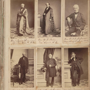
This Civil War-era photograph album contains cartes-de-visite photographs of members of the S. C. Secession Convention, Confederate and U.S. Governments, officers of the Confederate and U.S. Armies, S.C. governors, and officers of the South Carolina Volunteers 1st Regiment of Rifles. It also includes unidentified Heyward family and friends and 19th century pictures. Many photographs were …
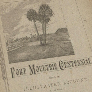
The Historical Commission of South Carolina pamphlet collection is comprised of 45 artificially bound volumes of separately published South Carolina imprints from the 19th and early 20th centuries. Topics covered include: agriculture, Civil War regimental histories, education and schools, geology, industry, medicine, Native American tribes, nature, nullification, the Revolutionary War, the Reconstruction Era (1865-1877), and …
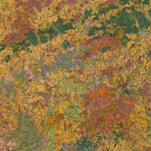
These forty South Carolina soil survey maps from the early Nineteen Hundreds were prepared with booklets to explain the soil classifications on the county level. They include information that do not appear on updated survey maps, such as old rail lines, schools, churches and other structures as well as entire towns that no longer exist.

Many of the over 700 photographs by Kenneth Frederick Marsh (d. 1968) available in this collection have not been published. Some were used to illustrate books by photographer Marsh and his wife, Blanche Marsh. The photographs and negatives depict historic and modern homes, public buildings, textile mills, churches, and scenes of South Carolina and Flat …
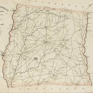
The 1825 publication of Robert Mills’ Atlas of the State of South Carolina marked an American cartographic first. This volume is the first systematic atlas of any state in the union. Remarkably, too, no other state atlas of South Carolina was published for the next century and a half.
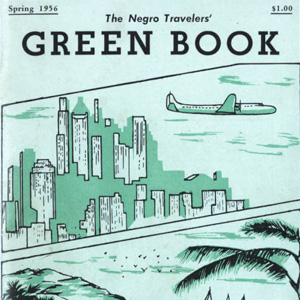
The Negro Travelers’ Green Book was a travel guide series published from 1936 to 1964 by Victor H. Green. It was intended to provide African American motorists and tourists with the information necessary to board, dine, and sightsee comfortably and safely during the era of segregation.

Originally conceived in the late 18th Century, fire insurance maps provided structural and urban environmental information necessary for insurance underwriters. Founded in 1867 in the United States, the Sanborn National Insurance Diagram Bureau systematically produced ascetically appealing, but also efficient, maps nationwide. This New York firm expanded and grew immensely, finally emerging as the Sanborn …

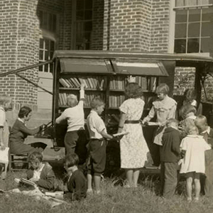
The South Carolina State Library and the South Carolina Digital Library present the South Carolina Bookmobiles Collection, a collection of historical and contemporary images from the 1940s to the early 2000s. The photographs are from the archives of the South Carolina State Library and many were taken by State Library field agents. Portrayed in photographs …
The South Carolina Public Library History, 1930-1945 collection consists of photographs and documents from the archives of the SC State Library. These digital images highlight public libraries, bookmobiles, librarians, and patrons from around the state. Many photographs and documents relate to the federal Works Project Administration (WPA) Library Project in South Carolina, which provided statewide library services …
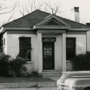
The South Carolina State Library and the South Carolina Digital Library present the South Carolina Library Buildings Collection, a collection of images of public library buildings in the state from the 1940s-1970s. The photographs are from the archives of the South Carolina State Library and many were taken by State Library field agents. Topics include …