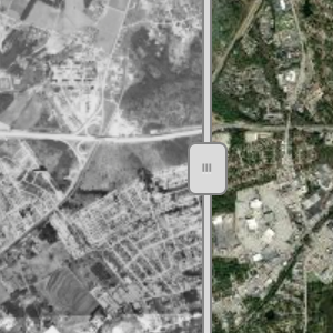
Thanks to funding by the Gaylord and Dorothy Donnlley Foundation, USC SCFloods, and other generous private and public donors, USC’s Government Information Department is able to make their historic aerial photography collection, spanning the 1930s to the 1980s, available online as georectified images. This site is user-friendly on laptops, tablets and phones. There is a transparency …
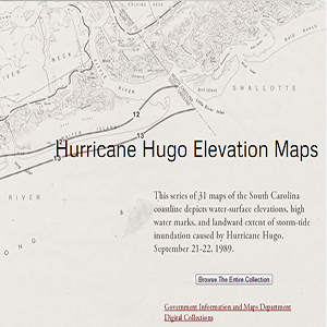
This series of 31 maps of the South Carolina coastline depicts water-surface elevations, high water marks, and landward extent of storm-tide inundation caused by Hurricane Hugo, September 21-22, 1989.
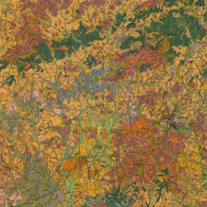
These forty South Carolina soil survey maps from the early Nineteen Hundreds were prepared with booklets to explain the soil classifications on the county level. They include information that do not appear on updated survey maps, such as old rail lines, schools, churches and other structures as well as entire towns that no longer exist.
This is a collection of over 700 South Carolina county road maps from 1930s to the 1990s, courtsey of the University of South Carolina Thomas Cooper Map Collection.

Spanning five decades, the University of South Carolina’s collection of aerial photograph indexes consists primarily of projects commissioned by the United States Department of Agriculture. Showing cities, farms, forests, reservoirs, coastlines, and other features across the state, the indexes provide a visual overview of each project’s collection of individual aerial photographs, many of which are …
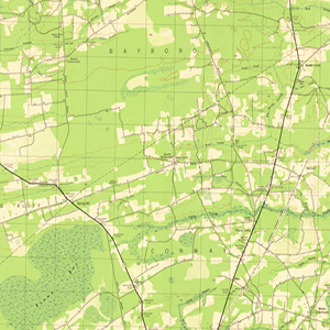
Measuring 14 ½ x 20 inches the Polyconic Projections were first published in the late 19th Century. Some were produced by the Army, others by the Corps. of Engineers and the remainder were produced by the United States Geological Survey (USGS). The scale is 1:62500. The contour intervals vary. Measurements are shown in miles, feet …