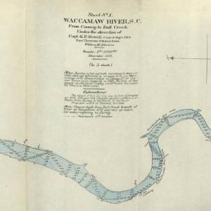
This collection contains five maps of the Waccamaw River in Horry County, S.C. from Conway to Bull Creek dated November 1903. The surveys were performed under the direction of Captain G. P. Howell, Corps of Engineers U.S.A. and Reid Whitford, U.S. Assistant Engineer. The surveyor was William H. Johnstone. These five maps show the soundings …

The South Carolina Library Association, established on October 27, 1915, is made of librarians from all around our state South Carolina dedicated to providing innovative services and promoting libraries and intellectual freedom to all our citizens including the public, as well as those in higher education and in our schools.
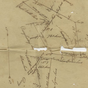
Chesterfield County Library has digitized a collection of family papers from the Spencer Family circa 1780s-1910s.
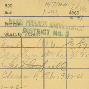
Chesterfield County Library digitized several historical documents from their library circa 1930s-1940s, including due date cards, a library card application, and list of books sent to Florence to be mended.
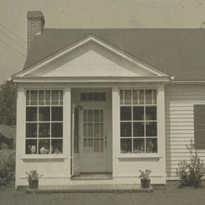
Chesterfield County Library digitized several historical documents from their library including photographs of buildings in Cheraw such as Brown’s Gift Show and the Stricklin Building.
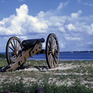
Wide array of 35mm color slides, ranging from grounds of Fort Sumter and Fort Moultrie to images of illustrations and printed material.
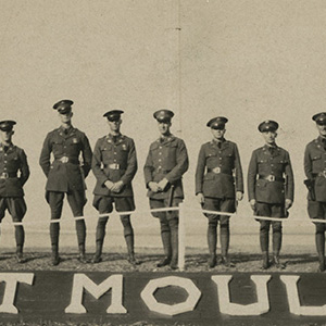
Images of military use of Fort Moultrie, South Carolina mostly during World War I and World War II.
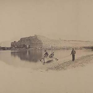
Images of the damage sustained to Fort Sumter during bombardment. These images were given as gifts to attendees of the ceremonies of restoring the National Flag by Gen. Anderson on the Ramparts of the Fort on the 14th April 1865.

The Color Slides of South Carolina State Parks Collection is composed of images taken by staff of the South Carolina State Park Service from 1969 to 2007. This collection documents the administration and public use of the parks. It includes photographs of park scenery, recreational activities, historic sites, interpretive programs, maintenance work, natural and cultural …
The Black and White Negatives of South Carolina State Parks is primarily composed of images taken by the State Forestry Commission, the agency which operated the parks from 1934-67. Additional black and white negatives in this collection were produced by the State Park Service in the 1970s. This collection documents the administration and public use …