About

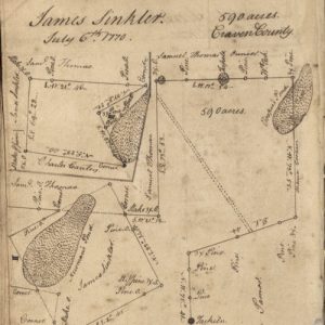
This item is a surveyor’s duplicate book of plats attributed to noted surveyor, civil engineer, and map maker Henry Mouzon. Mouzon conducted surveys for the first map drawn to scale of North and South Carolina, which was published in London in 1775. This book includes an index to the names of property owners and the plats depict land in Craven, Colleton, and Berkeley Counties as well as a lot in Charles Towne.
Related Terms:
- South Carolina Historical Society
Institution:
- Maps
Media Types:
- Berkeley County,
- Charleston County,
- Colleton County
