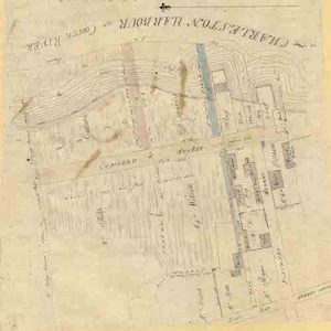
The City Engineer’s Plat Book, 1671-1951 is an oversize book containing plats of Charleston properties. It was assembled by the office of the City Surveyor in the City Engineer’s Office. All plats are of properties within the City of Charleston, ranging from individual parcels, or pieces of parcels, to whole neighborhoods. While there is no …
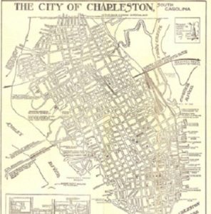
This small map collection features original and facsimiles of historic maps of Charleston. Additional maps may be added in the future.
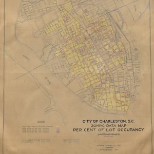
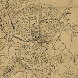
This collection consists of ten maps that were produced in conjunction with the preparation of the City of Charleston’s 1931 Report of the City Planning and Zoning Commission Upon a Program for the Development of a City Plan with Specific Studies of Certain Features Thereof. The report, prepared by Morris Knowles, Inc., paved the way …
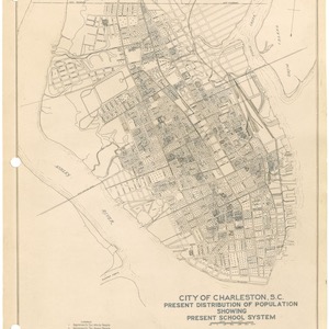
The Charleston Library Society’s copy of the City of Charleston’s 1931 Report of the City Planning and Zoning Commission Upon a Program for the Development of a City Plan with Specific Studies of Certain Features Thereof was prepared for the city by Morris Knowles, Inc. The report contributes to the growing work surrounding the acknowledgement of race-based …

The selected manuscripts date from as early as 1774 and contain evidence of the lives and experiences of enslaved persons in South Carolina. The items include bills of sale, plantation ledger lists, land plats, court records, family papers, correspondences, labor contracts, last will and testaments and estate records. These manuscripts have proven essential in genealogical …
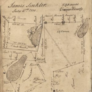
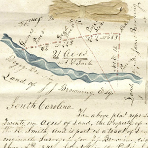
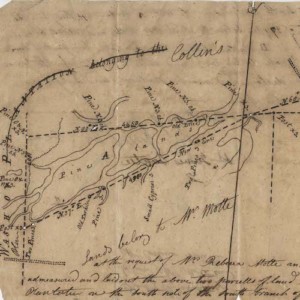
This item is a surveyor’s duplicate book of plats attributed to noted surveyor, civil engineer, and map maker Henry Mouzon. Mouzon conducted surveys for the first map drawn to scale of North and South Carolina, which was published in London in 1775. This book includes an index to the names of property owners and the …
Thomas Smith, born in Exeter, Devon, England in 1648, came to South Carolina in 1684. He became a Landgrave in 1691 and Governor of South Carolina in 1693. His son, Judge Thomas Smith, Jr., Second Landgrave (1670-1738) bequeathed to his brother and sons acres of his Goose Creek lands, his Wassamasaw lands, and a proportional …
Collection of historic maps of Greenville County and the City of Greenville
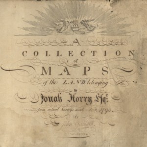
The Colleton County Memorial Library Map Collection currently contains a sampling of images from the historic maps in the holdings of Colleton County Memorial Library. Included in this collection is the Jonah Horry Book of Maps, which features maps, surveys and charts drawn by John Goddard and John Horry Dent.
This collection primarily consists of over two hundred eighteenth and nineteenth century plats pertaining to properties in the Lowcountry region of South Carolina. Plats include the parish of St. Thomas & St. Denis, St. Andrew’s Parish, Prince Frederick, St. Stephen’s Parish, St. Luke’s Parish, St. Peter’s Parish, St. John’s Parish, St. Bartholomew’s Parish, St. Paul’s …