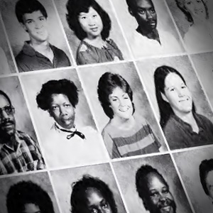
The digital collection of Florence-Darlington Technical College chronicles the college’s history. The Florence-Darlington Technical College, Wellman, Inc. Library digital collections include digitized yearbooks and other items related to the history of the college. This collection features college publications which record events and people from the 1960’s through the 1990’s.
Forward Together is a multiple-venue project, developed by a consortium of historical and educational institutions, that focuses on the participation of South Carolina during World War I and its effects on the state. Through exhibitions, public lectures, and the development of curricula, this project gives the community a better understanding of the twentieth century’s economic, …
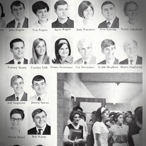
The university archives of Francis Marion University are housed in the James A. Rogers Library. These digital collections begin with the college yearbooks. Francis Marion University is a four-year liberal arts university in Florence, SC. The institution began as a University of South Carolina regional campus and became a state-supported college in 1970. Named Francis …
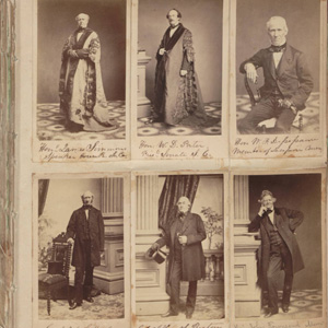
This Civil War-era photograph album contains cartes-de-visite photographs of members of the S. C. Secession Convention, Confederate and U.S. Governments, officers of the Confederate and U.S. Armies, S.C. governors, and officers of the South Carolina Volunteers 1st Regiment of Rifles. It also includes unidentified Heyward family and friends and 19th century pictures. Many photographs were …
The Historical Commission of South Carolina pamphlet collection is comprised of 45 artificially bound volumes of separately published South Carolina imprints from the 19th and early 20th centuries. Topics covered include: agriculture, Civil War regimental histories, education and schools, geology, industry, medicine, Native American tribes, nature, nullification, the Revolutionary War, the Reconstruction Era (1865-1877), and …
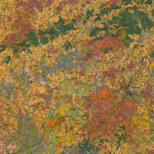
These forty South Carolina soil survey maps from the early Nineteen Hundreds were prepared with booklets to explain the soil classifications on the county level. They include information that do not appear on updated survey maps, such as old rail lines, schools, churches and other structures as well as entire towns that no longer exist.
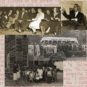
This core unit of three hundred fifty items-two hundred sixty-two manuscripts (letters, speeches, reports, narratives, and affidavits) and miscellaneous printed artifacts (news clippings, programs, booklets), and eighty-eight photographs-added to the papers of the late Joseph Armstrong De Laine (1898-1974) covers chiefly the period from 1942, when he submitted his annual report as secretary of the …
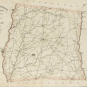
The 1825 publication of Robert Mills’ Atlas of the State of South Carolina marked an American cartographic first. This volume is the first systematic atlas of any state in the union. Remarkably, too, no other state atlas of South Carolina was published for the next century and a half.
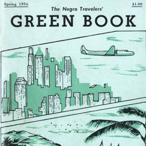
The Negro Travelers’ Green Book was a travel guide series published from 1936 to 1964 by Victor H. Green. It was intended to provide African American motorists and tourists with the information necessary to board, dine, and sightsee comfortably and safely during the era of segregation.
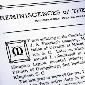
Charles Crosland (1845-1918), who served in the 19th South Carolina Cavalry Battalion, with Company H of the Confederate Army’s Hampton Legion, recounts his combat experiences, his father’s death, and the destruction of the Crosland family plantation in Bennetsville. He also references the sinking of the USS Housatonic by the Confederate submarine, the H.L. Hunley. Lula …