
This collection reflects coursework by students at the University of South Carolina Honors College exploring the 2020 election and civic engagement. Developed in 2019, before the presidential match-up was determined, the course emphasized exploration of all viewpoints and the many ways citizens can engage with their larger community around the political process. Interviewees range in …
The Pee Dee District Dental Society Records, 1933-1988, consist of one volume of recorded minutes, treasurer’s reports, membership records, and added correspondence and newspaper clippings which document the society’s activities. Included are summaries of papers and discussions presented to the society at its regular meetings. Membership lists and financial documentation are recorded. Actions taken by …

This is an electronic resource from the Gregg-Graniteville Library at University of South Carolina, Aiken
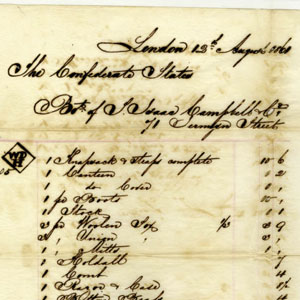
Colin J. McRae (1813- 1877) became the chief financial agent for the Confederate government in Europe from 1863 until the end of the war. An astute businessman prior to the war, he had served as an agent for the Confederate Ordnance Bureau from July 1862 until he went to Europe a year later. On his …
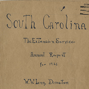
Items in this collection represent annual reports for the extension state and county offices, as well as separate reports for the African American extension agents. Started in 1907 with Dr. Seaman Knapp, an agriculturist and special agent for the USDA, the program was intended to be farm demonstrations to instruct farmers on proper farming techniques. …
With a public service career spanning over 70 years, the speeches of Senator Strom Thurmond document the evolution of his thoughts, opinions, and philosophies in all of the public offices he held – State Senator, Circuit Judge, Governor, and U.S. Senator. These speeches available online are only a small portion of the Strom Thurmond Collection. …
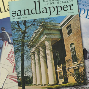
Sandlapper, the Magazine of South Carolina, was established in 1968 by the Lexington lawyer Robert P. Wilkins, Sr. and his wife Rose. Concerned about South Carolina’s image, Wilkins began promoting the state’s beauty, citizens, and history through the magazine. The first issue appeared in January 1968 with a portrait of Governor James F. Byrnes on …
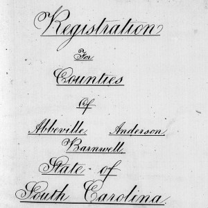
This abstract was created by order of the commander of the Second Military District in accord with 14 U.S. Stats. 429, 15 U.S. Stats.2, and 15 U.S. Stats. 14, which gave him ultimate responsibility for the registration of voters and the conduct of elections. The series was abstracted prior to 12 September 1868 from the …
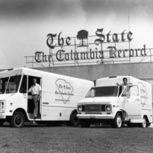
The images in this collection are selections from the photographic archives of The State Media Company, which are stored at Richland Library. This digital collection will continue to grow as more historic photographs are digitized. A finding aid for the archive is available. The photographs in the archive date from 1955 to 2002 and were taken by …
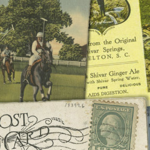
This digital collection features postcards from across the State of South Carolina. Browse this collection by county, or keyword search collection metadata using the search box. 10 counties are currently available, and more counties will continue to be added in the future. The originals are housed at South Caroliniana Library.