About

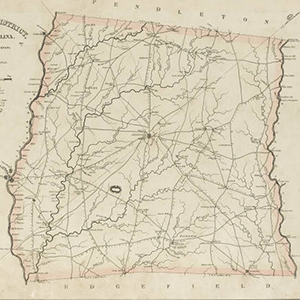
The 1825 publication of Robert Mills’ Atlas of the State of South Carolina marked an American cartographic first. This volume is the first systematic atlas of any state in the union. Remarkably, too, no other state atlas of South Carolina was published for the next century and a half.
Related Terms:
- Maps
Media Types:
- Abbeville County,
- Aiken County,
- Allendale County,
- Anderson County,
- Bamberg County,
- Barnwell County,
- Beaufort County,
- Berkeley County,
- Calhoun County,
- Charleston County,
- Cherokee County,
- Chester County,
- Chesterfield County,
- Clarendon County,
- Colleton County,
- Darlington County,
- Dillon County,
- Dorchester County,
- Edgefield County,
- Fairfield County,
- Florence County,
- Georgetown County,
- Greenville County,
- Greenwood County,
- Hampton County,
- Horry County,
- Jasper County,
- Kershaw County,
- Lancaster County,
- Laurens County,
- Lee County,
- Lexington County,
- Marion County,
- Marlboro County,
- McCormick County,
- Newberry County,
- Oconee County,
- Orangeburg County,
- Pickens County,
- Richland County,
- Saluda County,
- Spartanburg County,
- Sumter County,
- Union County,
- Williamsburg County,
- York County
