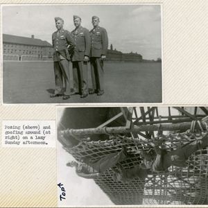
The Lawrence Layden Scrapbook contains photographs and papers documenting his wartime service. Lawrence Layden was a Captain in the 67th Tactical Reconnaissance Group during World War II. Personal papers consist of induction papers, forms listing the date for reverting to inactive service, military security passes, promotion papers, transfer papers, letters of recommendation to attend Officer Candidate …
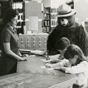
The South Carolina State Library and the South Carolina Digital Library present the South Carolina Children’s Library Services Collection, a collection of historical and contemporary images from the 1940s-2000s relating to library services for children. The photographs are from the archives of the South Carolina State Library and many were taken by State Library field …
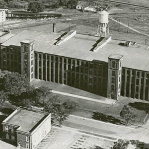
The Carolina Textile Mills Collection provides photographs, maps, blueprints, ephemera, letters, guidebooks and more documenting textile mill history in Upstate South Carolina from various textile mill related collections held by the Clemson University Special Collections unit. Images in this collection were taken from the M. Lowenstein collection, the Neil Campbell collection, the Dill Family collection, …
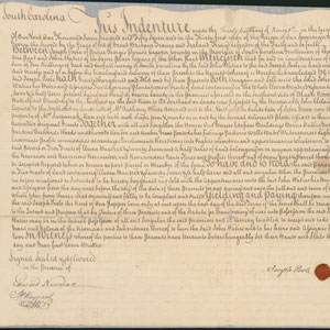
The Eighteenth and Nineteenth Century Real Estate Indentures Collection features images of rare and original handwritten documents that tell the history of Georgetown County. The collection includes real estate indentures, land grants, survey maps, conveyance of land, titles, mortgages and agreements from the early residents including the Brockingtons, the Fords, the Heywards, the Porchers, the …
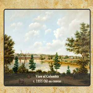
The Fall Line is a geographic region within South Carolina where the rivers are no longer navigable from the Low Country. This area, which stretches from Cheraw on the Pee Dee River to Hamburg (present day North Augusta) on the Savannah River, yielded experiences and material culture that were characteristic of its peoples. The goods …
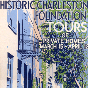
One of the first fundraising programs developed by Historic Charleston Foundation after its incorporation in 1947 was its annual spring tours of historic houses, during which trained “hostesses” would guide visitors through several private homes in Charleston’s historic district. In addition to raising revenue to support Historic Charleston Foundation’s preservation efforts, the tours performed an …
These forty South Carolina soil survey maps from the early Nineteen Hundreds were prepared with booklets to explain the soil classifications on the county level. They include information that do not appear on updated survey maps, such as old rail lines, schools, churches and other structures as well as entire towns that no longer exist.
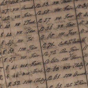
This collection contains diaries of James Kershaw, 1791-1825, with meteorological observations, recipes, and home remedies, including advice for treatment of pimples, boils, baldness, and unwanted hair. The papers record observations, 17 September 1811, of a solar eclipse, accounts of debts paid, January-April 1812, including prices of cotton, molasses, and sugar, and typed abstracts of recipes, …
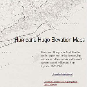
This series of 31 maps of the South Carolina coastline depicts water-surface elevations, high water marks, and landward extent of storm-tide inundation caused by Hurricane Hugo, September 21-22, 1989.
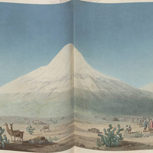
The German scientist Alexander von Humboldt and his expedition partner, botanist Aimé Bonpland, traveled through Central and South America between 1799 and 1804. Under a Spanish warrant, they explored the Orinoco in Venezuela, surveyed and gathered plant and animal specimens, and studied the geology and mineralogy of Colombia, Peru, and Mexico. They climbed Chimborazo, the …