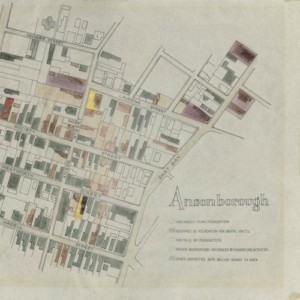
In the 1950s many houses in Ansonborough were threatened with ”demolition by neglect,” having stood vacant or fallen into severe disrepair. In order to encourage homebuyers to move into the neighborhood to save these formerly unwanted treasures, Historic Charleston Foundation (HCF) was the first organization in the country to develop the Revolving Fund as a …
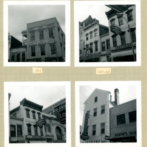
In 1967, Historic Charleston Foundation was deeply concerned about the conditions of the downtown area, particularly the commercial blocks of King Street. Because the Foundation believed that the survival of King Street as a thriving retail shopping district was vital, it launched a feasibility study to determine the potential of the area. The study examined …
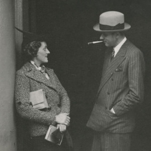
Gertrude Sanford Legendre (1902–2000) was an American socialite who served as an OSS operative during World War II. She was also a noted explorer, big-game hunter, environmentalist, and owner of Medway plantation in South Carolina. The collection includes scrapbooks of Gertrude’s travels and family life, loose photographs ranging in date from the mid to late …
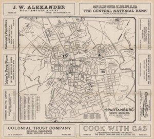
This selection of maps illustrates the development of Spartanburg County from an isolated settlement to a regional center as few other historical resources can. In addition to documenting areas rarely photographed, maps can be useful to researchers interested in charting the changes in land use for a given geographic area. Information included in many of …

Giovanni Battista Piranesi (1720-1778) was an innovative graphic artist who is most known for architectural studies of Rome and his imaginary prisons. The Irvin Department of Rare Books and Special Collections at the University of South Carolina holds a rare complete set of his posthumous Opere [Works] (1837-9), which consists of twenty-nine elephant-folio volumes that …

A joint project of the Native American Studies Archive at the University of South Carolina Lancaster, the University of South Carolina’s Institute for Southern Studies, and the University of South Carolina Libraries’ Digital Collections. NASCA will expand the research and service impact of the University of South Carolina Lancaster’s Native American Studies Center and Archive, …
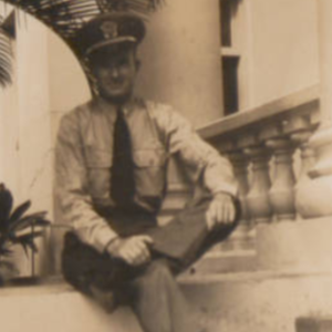
This collection is comprised of first hand accounts, logs, and photographs of life on the U.S.S. Landing Craft Infantry 759 during World War II. The journaled account was written by Gerald Atherton forty years after his experiences. The Executive’s morning order book was kept by Lt. O.H. Wienges while on the Naval ship. The collection …
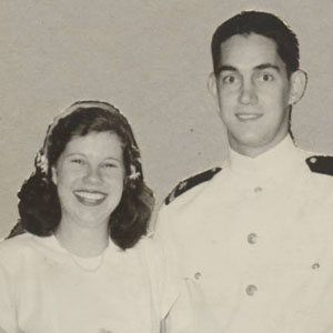
This collection includes both a bound (1944-1949) and an unbound (1935-1969) scrapbook, and each book offers a snapshot into the life of Jim and Marian Robinson. Letters, photos, and newspaper clippings are all included in this collection.
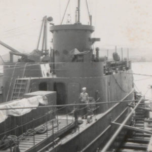
This collection is comprised of first hand accounts, logs, and photographs of life on the U.S.S. Landing Craft Infantry 759 during World War II. The journaled account was written by Gerald Atherton forty years after his experiences. The Executive’s morning order book was kept by Lt. O.H. Wienges while on the Naval ship. The collection …
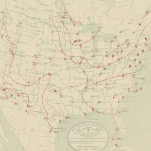
The bulletins published in these volumes exhibit the record of simultaneious observations, taken daily, at 7:35 a.m., 4:35 p.m., and 11 p.m., Washington time. The observations are given as copied from the original reports of the observers. See the catalog record for more information.