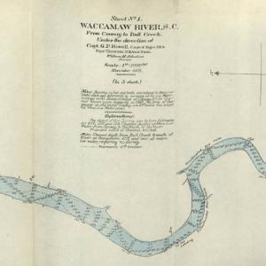
This collection contains five maps of the Waccamaw River in Horry County, S.C. from Conway to Bull Creek dated November 1903. The surveys were performed under the direction of Captain G. P. Howell, Corps of Engineers U.S.A. and Reid Whitford, U.S. Assistant Engineer. The surveyor was William H. Johnstone. These five maps show the soundings …
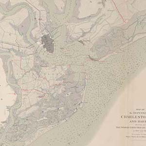
Collection of printed and hand-drawn maps of Charleston Harbor and Fort Wagner, South Carolina and nearby areas of North Carolina and Georgia. Of particular interest are the drawings depicting batteries and approaches on Morris Island during the Siege of Charleston, 1863.
The Greenwood County Library Map Collection includes city, county, topographical maps, soil surveys, and plats from Greenwood and surrounding areas. Digitization assistance provided by the South Carolina State Library’s Digitization in a Box Program.
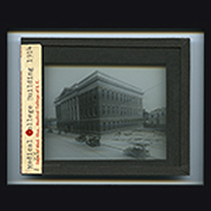
The Medical College Expansion Program Lantern Slides, 1954-1974, digital collection consists of portions of two separate archival collections of the MUSC University Archives, capturing the architectural development and construction on the growing campus of the Medical College of South Carolina. The slides of ARC 101 comprise a series of the Kenneth M. Lynch, Sr., M.D., …
Thomas Green Clemson demonstrated the versatility which gifted people often possess in his varied activities as a mining engineer, government official, plantation owner, scientist, proponent of higher education, artist and art collector, and supporter of scientific farming. Born in Philadelphia, Pennsylvania, Clemson adopted South Carolina as his home after marrying Anna Maria Calhoun, the oldest …
The map collection of the South Caroliniana Library has always been a significant resource for geographers, historians, and genealogists. In the past two hundred years, technological changes have substantially altered the landscape of South Carolina, and the library’s map collection visually documents these transformations. The maps show airports, battlefields, cemeteries, churches, cities, highways, Native American …
This series of 31 maps of the South Carolina coastline depicts water-surface elevations, high water marks, and landward extent of storm-tide inundation caused by Hurricane Hugo, September 21-22, 1989.
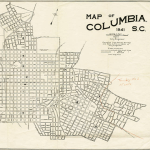
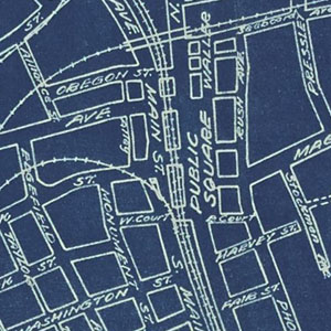
The Maps of Columbia and Richland County collection features an assortment of historic maps of Columbia and the surrounding areas. These maps depict streets, political boundaries, and school zones from the early twentieth century. These maps along with additional maps are located in the Walker Local and Family History Center at Richland Library.
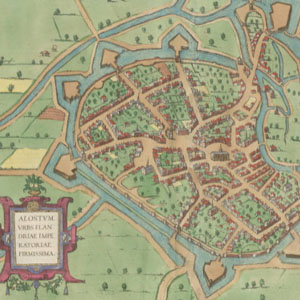
The John and Mary Osman Braun and Hogenberg Collection contains a variety of maps from the late 16th and early 17th centuries, primarily from the Civitates Orbis Terrarum (Cities of the World) by Georg Braun and Franz Hogenberg. The Civitates is considered one of the first modern atlases and it captures an exciting glimpse into the past through the …
The Civic Services Committee (CSC) (1942-1946) was the predecessor body to Historic Charleston Foundation. It was formed by the Carolina Art Association to address the need for architectural preservation and to implement city planning in response to growth. The Committee received grants from the Rockefeller Foundation and Carnegie Corporation, which were used to retain Frederick …