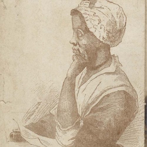
This collection containes a scrapbook, compiled by James H. Holloway (1849-1913), which contains legal documents, personal and business correspondence, receipts, ephemera, clippings and photographs pertaining to the Holloway family, a prominent free family of color in Charleston, SC. Legal documents include deeds (1806, 1821, 1871), a conveyance (1811), slave bills of sale including one for …
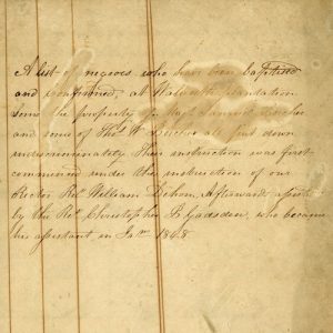
The Ellinor P. Gadsden Family Papers, 1848-1970, contains a small bound volume kept by Ellinor Cordes Porcher (1810-1888) that records the baptisms performed on enslaved people, both alive and deceased, between 1848-1853. These enslaved men, women and children belonged to Major Samuel Porcher (1768-1851) and Dr. Thomas W. Porcher (1807-1889), and baptisms were performed by …
The Elizabeth W. Allston Pringle Family Papers, 1861-1926, collection includes two bound volumes kept by members of the Allston family. The Allston-Pringle Plantation Account book created in 1867 documents the laborers who worked at Allston properties such as White House, Chicora Wood and Greenfield Plantation in Georgetown County, South Carolina. Recorded by Adele Petigru Allston, …
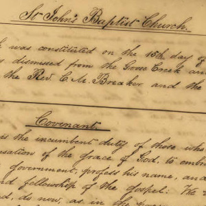
This collection is comprised of all things Pinopolis (documents, photographs, and ephemera).The records of St. John’s Baptist Church in Pinopolis from 1851-1890 are the first addition to this collection.
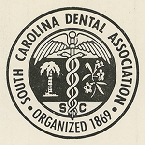
The South Carolina Dental Association was established in 1869. Among its early purposes was to advocate against quack dental practitioners who lured clients with deceptive advertising. In 1875, the SCDA achieved passage in the SC General Assembly of the state’s first dental practice act which called for the election of a board of examiners authorized …
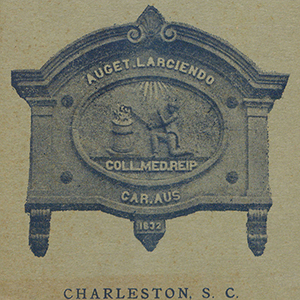
The MUSC Bulletin is an official publication of the Medical University of South Carolina primarily for students. Beginning in 1825 as a simple list of Medical College students, graduates, and faculty, the Bulletin expanded over time to include additional information about the curriculum, facilities, hospital access and privileges, fees, and admission and graduation requirements. Over …
The Pinckney Family Papers, 1708-1847, collection consists of two bound volumes kept by members or for members of the Pinckney family. Several members of the Pinckney family have been distinguished for service to South Carolina and the United States. Eliza Lucas Pinckney helped make indigo a major cash crop; she was the mother of two …
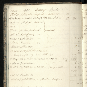
The Charleston Dental Association was first organized in December 1867 at the office of Dr. J. B. Patrick, Sr. on Society Street in Charleston “for the advancement of our Profession and to engender …good fellowship.” The first dental association in the state, the group met monthly to demonstrate new techniques, discuss current practices and socialize. …
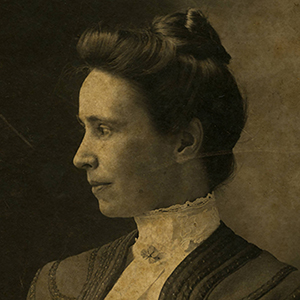
The Sarah Campbell Allan, M.D., Papers, 1895-1954, include a letter from John Gary Evans, Governor of South Carolina, offering her a position at the South Carolina State Lunatic Asylum; a copy of her will and other estate papers; her 1900 diary, kept while working at the South Carolina State Hospital and a typescript of the …
The Mulberry Plantation Journals, 1853-1908 (bulk 1853-1889) collection is comprised of four bound journals containing records of Mulberry Plantation in Berkeley County, South Carolina kept by plantation owners John B. Milliken, Thomas Milliken and overseers C.A. Ward and R. Meynardie. Volume One kept by Thomas Milliken between 1853-1858, reports activities on the rice plantation such …